
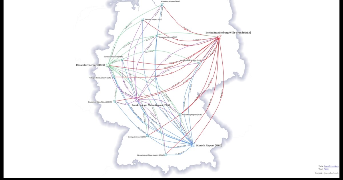
Day 30. Air distance in Germany ✈️
Straight lines between airports reveal network structure in ways route maps often cannot.
This visualization maps direct air distances between German airports in QGIS. No flight paths, no routing algorithms, just geometric connections between origin and destination points. Each line represents the shortest theoretical link, and the density of intersections hints at which airports function as spatial hubs.
The work was inspired by Anita Graser’s “New style: flow map arrows”, particularly the way simple lines can be styled to emphasize direction and structure without adding unnecessary complexity.
What emerges is less about airline strategy and more about geography. Some airports connect widely simply because of where they sit relative to population centers.
The challenge is not technical difficulty, but visual density. When hundreds of connections overlap, clarity depends on restraint.
Sometimes the simplest geometric operation reveals the strongest pattern.
Live demo: Air distance Germany
The project
| Piece | Role |
|---|---|
| Tool | QGIS |
| Geometry | Origin-destination straight lines |
| Inspiration | Anita Graser: New style: flow map arrows |
| Hard part | Visual density / restraint |
How to follow
- Blog: blog.maptheclouds.com
- LinkedIn: Day 30 post
- Live demo: Air distance Germany
- Previous: Day 29: Romania Population Mosaic
- Hashtag: #100DayMapChallenge
#100DayMapChallenge · Day 30/100 · LinkedIn
Previous: Day 29: Romania Population Mosaic
Next: Day 31