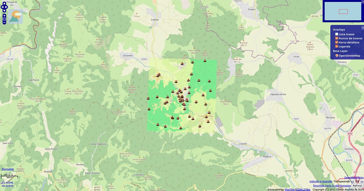
The map that started everything. 🗺️
Aiudului Gorges, Romania. 2011. A place close to my heart. I still go there to hike and climb, and I know the terrain well. I was fascinated by the karst topography. The Trascău Mountains are rich with this type of relief, and I wanted climbers to see routes on a web map before GPS was in every pocket.
I digitized every contour line by hand from a topographic map. The same base map I used for my bachelor’s thesis became the foundation for this web project. I generated tiles with MapTiler and GDAL2Tiles, then rendered them in OpenLayers. This was before Three.js reached cartography, when the web was slower and WebGL was far from mainstream.
But the question was already there: how do we make terrain feel real online? ⛰️
Fourteen years later, I’m still asking it. The tools changed. The answers became more interesting.
This is where it started.
Live map: cheileaiudului.ro
The project
Cheile Aiudului (Aiudului Gorges) sits in the Trascău Mountains of Transylvania, Romania (approx. 46.38°N, 23.58°E). The area is karst terrain: limestone gorges, walls, and routes that read clearly on paper maps but were hard to share online in 2011.
The goal was practical: give climbers a web map of routes and terrain context before smartphones and GPS were everywhere. The stack was deliberately lightweight for the time: a scanned topographic base, hand-traced contours, tiled rasters, and OpenLayers for pan and zoom over OpenStreetMap.
Technical pipeline
| Step | Tool | Role |
|---|---|---|
| Base map | Topographic scan + manual digitizing | Contour lines traced by hand from the same sheet used in my bachelor’s thesis |
| Tiling | MapTiler, GDAL2Tiles | Raster tiles for web delivery |
| Client | OpenLayers | Map display, overlays, interaction |
| Basemap | OpenStreetMap | Geographic context under the custom terrain layer |
This was GIS-to-web workflow without WebGL: believable terrain came from line weight, hillshade cues on the source map, and careful overlay design rather than 3D mesh or shader work.
Why it still matters
Day 1 is not a portfolio highlight for visual polish. It is the origin point: terrain curiosity, manual cartography, and the question that runs through the whole campaign — how do we make geography feel real in a browser?
The live site at cheileaiudului.ro remains a work in progress. The 2011 version still documents the first answer: start with honest linework, ship tiles, keep the map usable.
How to follow
- Blog: blog.maptheclouds.com
- LinkedIn: Day 1 post
- Live map: cheileaiudului.ro
- Campaign announcement: Day 0
- Hashtag: #100DayMapChallenge
#100DayMapChallenge · Day 1/100 · Aiudului Gorges (2011) · LinkedIn
Previous: Day 0: Campaign announcement
Next: Day 2