
Day 61. Arctic Ocean 🌊
North is not always up, and a simple shift in perspective can change how we understand geography.
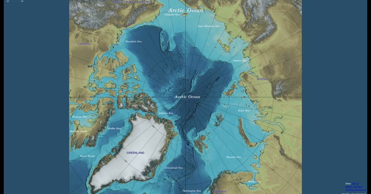
For Day 61, I built a 3D Arctic Ocean bathymetry view centred on the North Pole, using IBCAO data and related reference layers. Instead of reading the region as a distant edge, this framing places the Arctic Basin at the centre and makes continental shelves and submarine ridges easier to compare.
Implementation-wise, this is a Three.js scene rendering a pole-centred bathymetry map as a texture, using a lightweight shader material and OrbitControls for rotation. The goal is not full 3D terrain, but a clear orientation shift that stays crisp and readable.
It connects to a broader theme across the series: the same data reads differently depending on how it is framed. With the Arctic at the centre, the basin structure becomes the focus, not the edges.
A reminder that map orientation shapes what becomes visible first.
Live demo: Arctic Ocean
The project
| Piece | Role |
|---|---|
| Data | IBCAO bathymetry + reference layers |
| Stack | Three.js texture + lightweight shader + OrbitControls |
| Frame | North Pole centre; not full 3D terrain mesh |
| Theme | Orientation changes what becomes visible first |
How to follow
- Blog: blog.maptheclouds.com
- LinkedIn: Day 61 post
- Live demo: Arctic Ocean
- Hashtag: #100DayMapChallenge
#100DayMapChallenge · Day 61/100 · LinkedIn
Previous: Day 60: Star Map
Next: Day 62: Flowers