
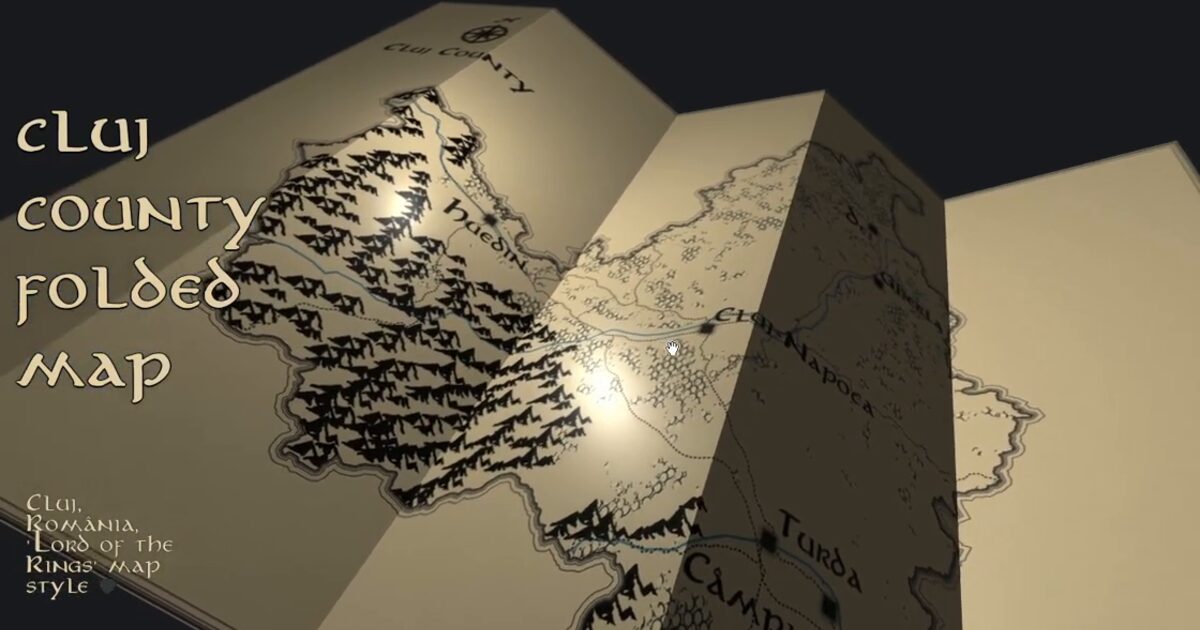
Day 70. Cluj County Folded Map 🐉🖤
Depth in a map does not have to come from terrain.
For Day 70, I am sharing a fantasy-style folded map of Cluj County, Romania, together with a short making-of. The base comes from the same QGIS map lineage used in Day 17, reworked here into a hometown piece with a storybook fantasy direction, inspired by Evelyn Nuuemaa’s style.
The workflow starts in QGIS, using OpenStreetMap layers for roads, water, and settlements, then moves into Blender where the map is placed on a foldable surface driven by hooks and constraints. The animation is exported and brought into the browser as a glTF model, where Three.js handles rendering, camera controls, and a lightweight interaction layer.
There is no actual 3D terrain in this piece. Depth comes from folding, lighting, texture, and camera movement.
It is a reminder that depth in a map can come from design, not just elevation.
Live demo: Cluj Folded Map
The project
| Piece | Role |
|---|---|
| Base | Same QGIS lineage as Day 17 |
| Pipeline | QGIS OSM → Blender folds → glTF → Three.js |
| Depth | Folding, lighting, texture, camera; no DEM mesh |
| Inspired by | Evelyn Nuuemaa style |
| Extra | Making-of video included |
How to follow
- Blog: blog.maptheclouds.com
- LinkedIn: Day 70 post
- Live demo: Cluj Folded Map
- Hashtag: #100DayMapChallenge
#100DayMapChallenge · Day 70/100 · LinkedIn
Previous: Day 69: Rainbow Cities
Next: Day 71: North Cube