
Day 14: Ten years later, same place, different tools 🔄
Aiudului Gorges in the Trascău Mountains has been one of my reference places for mapping since 2011. Back then, I built a climbing route map using MapTiler and OpenLayers. It was based on 2D tiles over OpenStreetMap, with one simple goal: help climbers understand routes on a web map when GPS wasn’t yet in every pocket. 🗺️
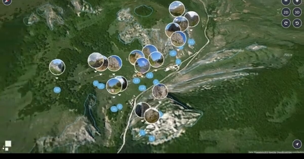
In 2021 I returned to the exact same location using ProceduralGL.js. Instead of static tiles, the terrain became smooth 3D rendered with WebGL and real elevation data. Routes could be draped over high-resolution topography, and the camera could move through the landscape in ways that resemble the actual hiking approach. 🏔️
The core question didn’t change: how do we help people understand terrain before they arrive?
But the answer evolved dramatically. What once meant overlaying lines on flat tiles now means showing spatial context, slope, and scale directly in the browser. Tools like ProceduralGL.js make possible in a few hundred lines what once required complex GIS exports and desktop workflows. The browser became the platform. 💻
This is what tool evolution looks like. The problems stay consistent. The solutions transform.
2011 map: cheileaiudului.ro · 2021 WebGL: cheile-aiudului-gl · Video: YouTube
The project
Day 1 introduced the 2011 climbing map. Day 13 framed 2021 as the brand year. Day 14 closes Week 2 by putting both eras on one place: Aiudului.
| Year | Stack | What the climber gets |
|---|---|---|
| 2011 | MapTiler + OpenLayers, OSM tiles | Routes on a 2D web map |
| 2021 | ProceduralGL.js + WebGL elevation | Draped routes, camera through terrain |
Same question. Different medium.
Why this day matters in the series
Tool evolution is not nostalgia. It shows that cartographic problems (read terrain before you arrive) outlast any one library. OpenLayers tiles solved discovery when GPS was rare. ProceduralGL made slope and scale legible in the browser. Week 3 starts client / applied work next (Sierra Leone education access in the campaign plan).
How to follow
- Blog: blog.maptheclouds.com
- LinkedIn: Day 14 post
- 2011: cheileaiudului.ro
- 2021: ProceduralGL demo
- Previous: Day 13 – 2021 year in review
- Hashtag: #100DayMapChallenge
#100DayMapChallenge · Day 14/100 · Aiudului tool evolution · LinkedIn
Previous: Day 13: The Year I Launched MapTheClouds