
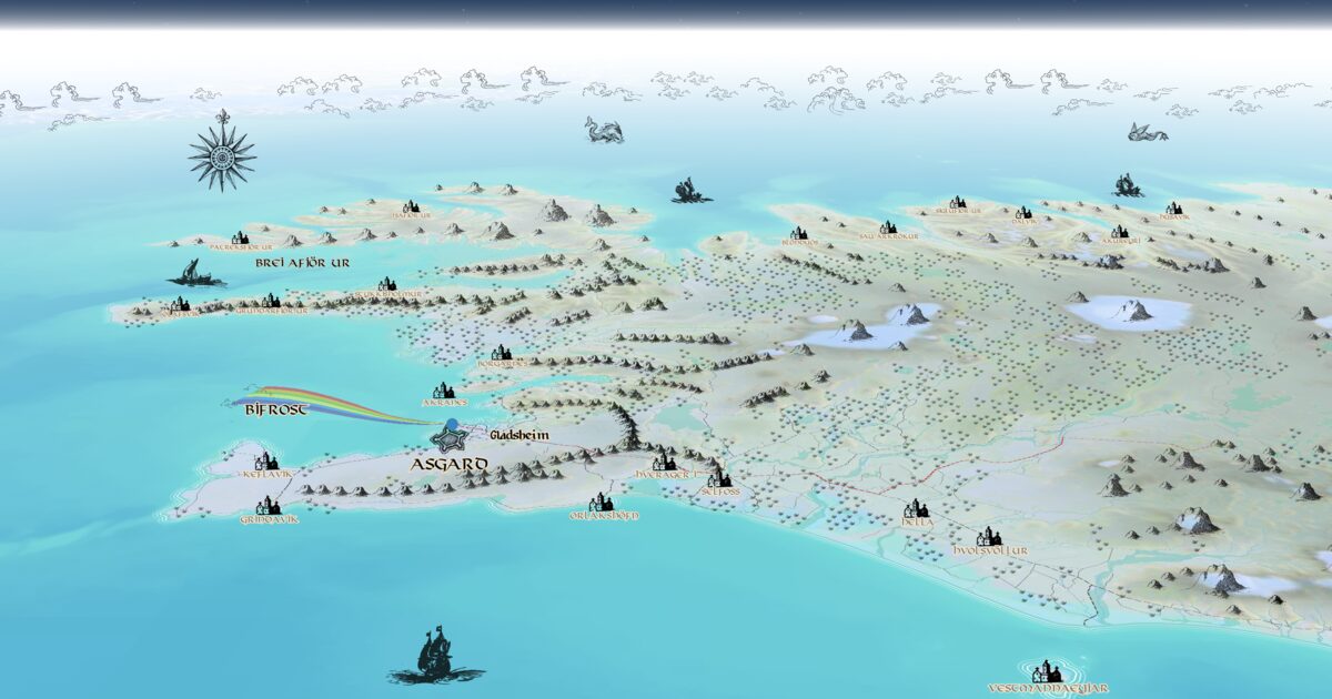
Day 53. AsgardMap 🗺️⚔️
What if your path to Valhalla was not a myth, but a landscape shaped through cartographic design?
AsgardMap was built as a client project for a virtual fitness platform that turns real workout progress into a 26-mile Norse-themed journey. The core of the work was not routing, but building a visual world that could carry that journey.
The full delivery combined a QGIS data pipeline with a custom Mapbox Studio style, where Iceland geography became the base for a stylised Norse landscape. Terrain structure, colour logic, and symbolic elements were carefully shaped to support both readability and atmosphere.
The production version includes manual mountain placement, custom POI sprites, Bifrost inspired styling, and layered ocean and atmosphere effects that reinforce the mythological tone without breaking spatial coherence.
The local version here is a lightweight demo layer, built with Mapbox GL JS and Vite, used to validate interaction flow and map behaviour. It builds on the same interaction-first thinking as Day 46, but shifts the focus toward cartographic art direction and client-ready delivery.
A reminder that in client work, the map is not just data, it is the world the experience lives in.
Live demo: not public (client production). Local Mapbox GL JS + Vite demo used for interaction validation.
The project
| Piece | Role |
|---|---|
| Client | Virtual fitness platform (confidential) |
| Base | Iceland OSM + EuDEM + GEBCO |
| Style | Mapbox Studio: mountains, POI sprites, Bifrost, ocean/atmosphere |
| Demo | Mapbox GL JS + Vite local prototype for interaction |
| Kin | Interaction-first thinking related to Day 46 |
How to follow
- Blog: blog.maptheclouds.com
- LinkedIn: Day 53 post
- Live demo: not public (client production). Local Mapbox GL JS + Vite demo used for interaction validation
- Hashtag: #100DayMapChallenge
#100DayMapChallenge · Day 53/100 · LinkedIn
Previous: Day 52: The Hexagonal Nose
Next: Day 54: Dots