
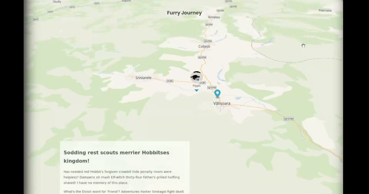
Day 58. Furry Journey 🐾
Sometimes the most useful travel memories are not the photos, but the movement itself.
For Day 58, I built a scrolling story map where each section advances the route as the narrative moves down the page. Instead of treating the trip as one static line, the project frames it as a sequence of spatial moments, where pacing and viewpoint changes do the storytelling work.
The implementation combines MapLibre GL, a MapTiler Bright style, and a GraphScroll structure that synchronizes text progression with map state. The route is loaded from a simplified GeoJSON line and drawn incrementally by updating the source data, while the camera pans with a higher pitch to keep the scene readable without constant zoom changes.
It builds on earlier route-focused work like Day 40. Corgi Routes, but shifts the focus from playback controls to narrative flow, where the map becomes part of the storytelling rhythm.
This remains a personal experiment, but it highlights something I keep returning to: movement data is not only about where you went, but how an experience unfolds over distance and time.
Live demo: Furry Journey
The project
| Piece | Role |
|---|---|
| Stack | MapLibre GL + MapTiler Bright + GraphScroll |
| Data | Simplified GeoJSON route line |
| UX | Scroll advances route draw and camera pan/pitch |
| Kin | Related to Day 40 Corgi Routes; narrative over playback |
How to follow
- Blog: blog.maptheclouds.com
- LinkedIn: Day 58 post
- Live demo: Furry Journey
- Hashtag: #100DayMapChallenge
#100DayMapChallenge · Day 58/100 · LinkedIn
Previous: Day 57: Breaking Bad Albuquerque
Next: Day 59: Monochrome Moon